Land surveying has undergone a remarkable transformation in recent years, with drone technology revolutionising how surveyors collect data, map terrain and analyse landscapes. Whether you are a professional surveyor, construction manager or agricultural specialist, choosing the right drone can significantly impact the accuracy, efficiency and cost effectiveness of your operations.
At NQ Aerovation, we understand the importance of selecting the right equipment for your surveying needs. As Australia’s trusted provider of agricultural drones, we offer complete solutions including sales, repairs and training to keep you flying. While our speciality lies in agricultural applications, the technology and expertise we provide also support surveying operations across a wide range of industries.
Understanding Drone Surveying Technology
Drone surveying, also known as UAV (Unmanned Aerial Vehicle) surveying or aerial photogrammetry, uses remotely piloted aircraft equipped with high resolution cameras, GPS systems and specialised sensors to capture detailed data about land and structures. This approach offers several advantages over traditional surveying methods:
- Reduced field time and labour costs
- Safe access to difficult or hazardous terrain
- High resolution imagery and accurate topographic data
- Rapid data capture across large areas
- Improved safety by limiting personnel exposure to risk
- A cost effective alternative to traditional methods and manned aircraft
Key Features to Consider When Choosing a Survey Drone
Camera Quality and Resolution
The camera is one of the most critical components of any surveying drone. Look for high resolution cameras of 20MP or higher to capture detailed imagery. RGB cameras are standard, while multispectral or thermal imaging may be beneficial for specialised applications.
GPS and Positioning Accuracy
Accuracy is essential in surveying. Modern survey drones often include RTK (Real Time Kinematic) or PPK (Post Processed Kinematic) systems, delivering centimetre level accuracy. This reduces the need for extensive ground control points and improves data reliability.
Flight Time and Coverage Area
Longer flight times allow greater coverage per battery cycle. Professional survey drones typically offer 25 to 45 minutes of flight time, improving efficiency on larger projects.
Weather Resistance and Durability
Surveying rarely occurs in ideal conditions. Drones with strong weather resistance and industrial grade construction are better suited to operate in wind, light rain and variable temperatures.
Automation and Intelligent Features
Autonomous flight planning, obstacle avoidance and programmed flight paths help streamline surveying workflows. These features reduce pilot workload, improve consistency and minimise human error.
Top Applications for Survey Drones
Construction and Infrastructure
Drones support progress monitoring, volumetric stockpile measurement and as built documentation, providing up to date insights for improved project management.
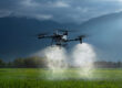
Agriculture and Land Management
Beyond crop monitoring, drones assist with land mapping, drainage planning, soil assessment and precision agriculture, making them invaluable across large farming operations.
Mining and Quarrying
Drone surveys assist with volume calculations, pit monitoring and environmental compliance, improving safety and operational efficiency.
Environmental Monitoring and Conservation
Drones allow non invasive tracking of erosion, vegetation health and land change over time, supporting conservation and environmental assessment projects.
NQ Aerovation: Your Partner in Professional Drone Solutions
While many suppliers focus purely on surveying drones, NQ Aerovation brings proven expertise in agricultural drone technology that directly applies to surveying use cases. Our experience with the DJI Agras range reflects our commitment to professional grade UAV solutions.
DJI Agras T100
The DJI Agras T100 represents the upper end of industrial drone capability. With a 100kg spray capacity, advanced positioning systems and autonomous flight features, it demonstrates the level of durability, automation and precision surveying professionals should expect.
DJI Agras T50
The T50 offers a balance of performance and efficiency, showcasing advanced positioning, intelligent flight modes and weather resistant design suited to demanding field operations.
DJI Agras T40
As an entry point to professional drone operations, the T40 delivers reliable mapping capabilities, precision controls and user friendly functionality while maintaining professional grade performance.
Why Choose NQ Aerovation
Comprehensive Sales Support
We provide complete drone solutions tailored to your operational requirements, helping you select the right equipment and configure it correctly from day one.
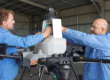
Professional Repair Services
Downtime impacts productivity. Our authorised repair services minimise disruption by delivering fast, reliable repairs using genuine parts.
Expert Training Programs
Operating professional drones requires skill and compliance. Our training programs cover licensing, safe operations, mission planning and data management to ensure legal and effective use.
Australia Wide Coverage
We support customers across Australia and understand the challenges of operating drones in diverse local conditions, from tropical North Queensland to southern regions.
Making the Right Choice for Your Surveying Needs
When selecting a surveying drone, consider the following:
- Your primary applications and project sizes
- Accuracy requirements and the need for RTK or PPK
- Budget for purchase and ongoing operation
- Training and licensing requirements
- Software compatibility and data workflows
- Maintenance and technical support availability
The most expensive drone is not always the best option. The right choice balances performance, reliability and long term support.
The Future of Drone Surveying
Drone surveying continues to advance rapidly. Improvements in artificial intelligence, sensor accuracy, LiDAR integration and flight endurance are making drone based surveying more powerful and accessible than ever.
Partnering with experienced providers ensures you stay aligned with these developments and maximise the value of emerging technology.
Conclusion
Choosing the right drone for land surveying is a strategic decision that affects efficiency, data quality and operational outcomes. Beyond the hardware itself, expert support, training and service are critical to success.
NQ Aerovation brings proven experience delivering professional grade drone solutions across Australia. Our work with the DJI Agras series reflects our commitment to performance, reliability and customer success. Whether you are entering drone surveying or upgrading your fleet, we provide the expertise and support you need.
Get Started with NQ Aerovation Today
Ready to explore how professional drone technology can enhance your surveying operations? Our team is here to help.
Phone: +61 404 621 187
Email: info@nqaerovation.com.au
NQ Aerovation provides agricultural drones across Australia. We sell, repair and train to keep you flying. Enquire today to discover how we can support your operations with professional grade drone solutions.
If you want, I can also tighten this for SEO, simplify it for a landing page, or adapt it to a more surveying focused angle rather than agriculture.