Commercial Operations

We’ve got the experience to support you – whether you need a pilot or want to become one!

Our experienced and fully qualified team are here to help you...

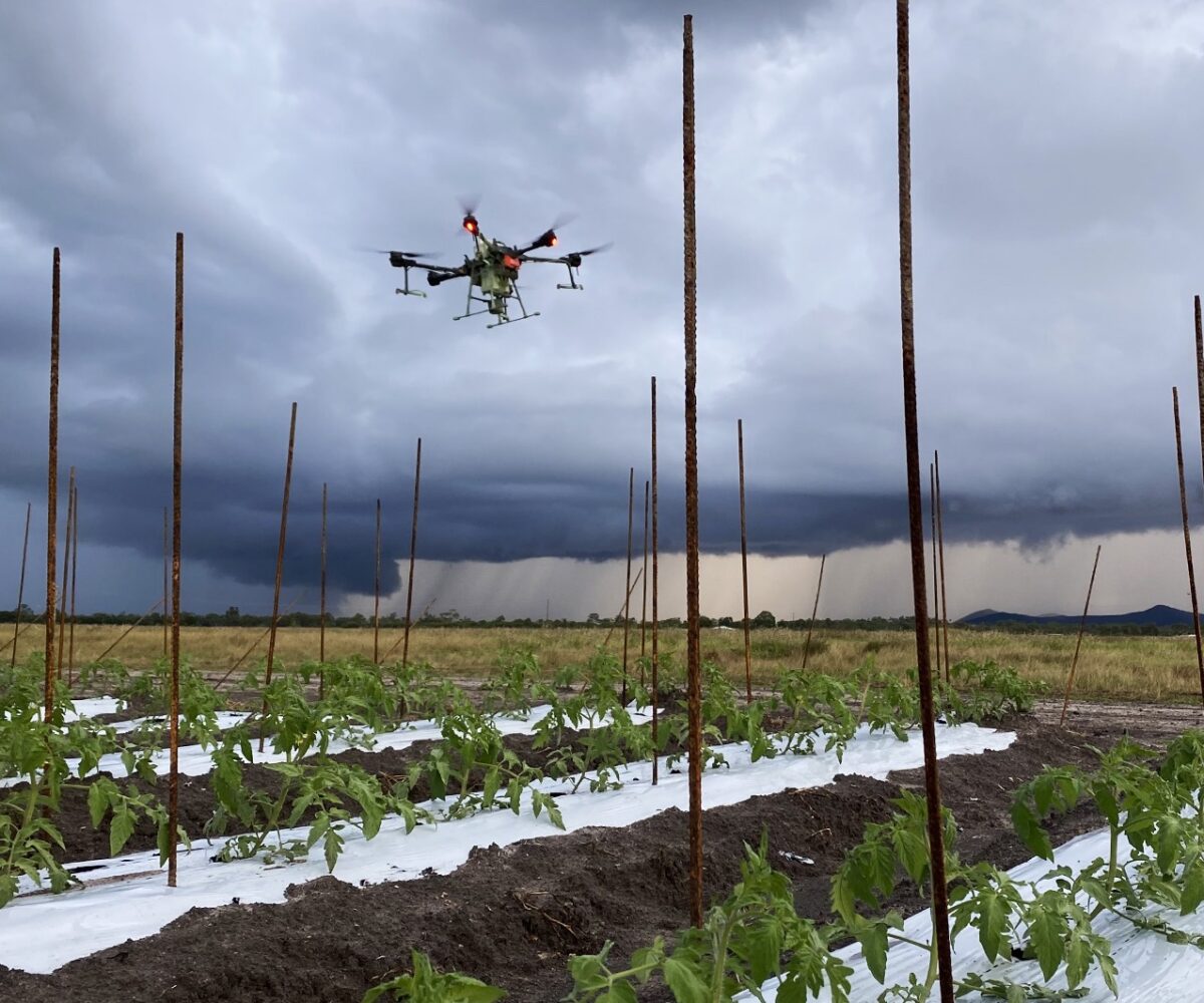
NQ Aerovation is a CASA-certified commercial UAV operator, fully licensed and insured to conduct drone operations across a range of categories — including day and night flights, and systems over 25kg. Our team holds industry-recognised certifications and operates under CASA.ReOC.1442.

Whether you need professional drone services or want to become a qualified pilot yourself, we have the experience, licensing, and infrastructure to support your journey from the ground up.

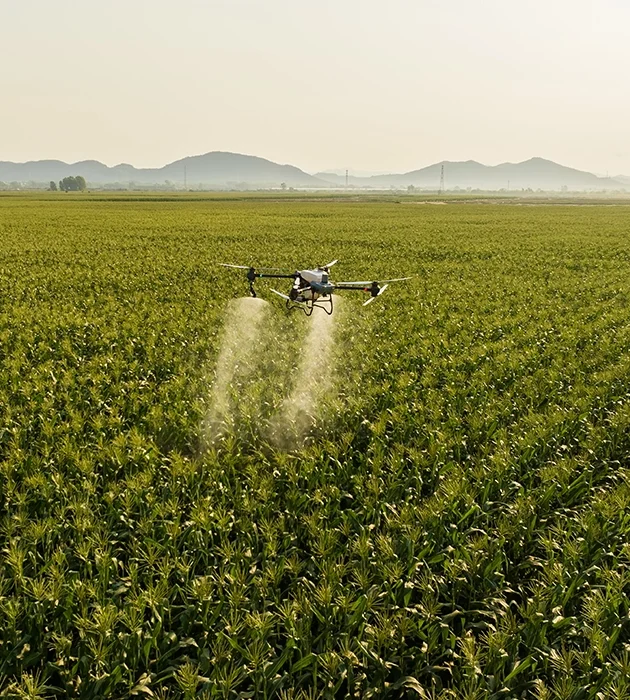
We are an end-to-end solution — an authorised DJI Agriculture dealership and certified DJI warranty repairer — helping our clients with everything from drone purchases and training to operational support and equipment repairs.

Our qualifications include:

  • Remote Operating Certificate (ReOC) – CASA.ReOC.1442

  • Remote Pilot Licence (RePL)

  • Aeronautical Radio Operator Certificate (AROC)

  • Certificate III in Aviation

  • Agricultural Chemicals Distribution Licence

  • Aerial Distribution Contractor’s Licence

  • Authorised DJI Agriculture Dealer

  • Certified DJI Warranty Repairer

  • Public Liability and Indemnity Insurance (up to $20 million)

Health & Safety

We are committed to providing a safe and healthy workplace, safe working methods, and the provision of safe equipment. Health and safety is considered to be an integral and vital part of the successful performance of any job.

Quality Assurance

We ensure our drone fleet run at full capacity through compliance with our stringent maintenance and decontamination program and pilot refreshment training to ensure a quality outcome every time.

Environment

We recognise our moral and legal responsibility to ensure that our activities, products, and services are designed to protect and enhance the environment in the communities in which we operate.

Record Keeping

NQ Aerovation distribute chemicals, fertilisers, and other substance responsibly and keep a record of all applications as outlined in the Agricultural Chemicals Distribution Control Act 1966.

Spraying & Spreading

With no ground compaction and the ability to cover challenging terrain, drones are the ultimate precision application tool, bringing efficiency and manageability to the agriculture and environmental sector. The latest DJI agriculture drones are capable of granular and liquid application of pesticides, herbicides, fertilisers and seeds in both broad-acre cropping and pastures as well as targeting invasive weeds and pests in challenging terrain such as waterways, dam walls, stockpiles, rail corridors and solar farms.
Combined with mapping and intelligent software, a DJI drone fleet can target specific areas where treatment is necessary, reducing chemical usage with effective, data-driven best practices.
With interchangeable spray nozzles for any application, optimal spray density is achieved with a swath of up to 9 meters and the downward airflow generated by the propellers results in a strong penetration.
An experienced Pilot can spray up to 100 hectares per day with a 40 litre water rate, treating crops quickly after a rain event, preventing disease and pest numbers rising.
Contact us to book a PilotGet your Spray Drone Endorsement

Access Challenging Terrain

Treat crops following a rain event when tractors are unable to operate.

Improve Biosecurity

Prevent the spread of disease and pests by reducing people and vehicle movement.

Environmental Savings

Accurate data, intelligent software and variable rate application targets specific areas where treatment is neccessary.

Cost Savings

Reduce chemical and fertiliser costs: and the potential costs of a fixed wing crop duster or helicopter.

Data Driven Decisions

Combined with intelligent software, drone payloads are capable of mapping crops with RGB and/or NDVI / NDRE imagery to identify and geo-reference areas growing unevenly or in poor health. This allows growers and agronomists to identify areas for on-ground analysis (such as soil sampling or pest/disease identification). Anomalies can be highlighted with vegetation indices to investigate several features about a plant, including the stage of its growth cycle, water stress levels, or even nutrient deficiencies. 

Once a problem has been identified, an appropriate treatment can be prescribed and base maps for precision equipment such as spray drones can be generated for target application reducing input costs.

Explore the DJI Mavic 3MGet your Remote Pilots Licence!

LiDAR

The precision of a DJI LiDAR payload is particularly beneficial in environmental management – supporting successful land remediation works, disaster recovery works, riverbank management as well as targeting and controlling invasive species.

Lidar, with its laser-based scanning capabilities, offers unparalleled precision in mapping and surveying landscapes. Its ability to capture detailed 3D data facilitates more accurate terrain modelling, ensuring a comprehensive understanding of topography and environmental features.

Lidar stands as a technological cornerstone, propelling industries into a new era of spatial intelligence.

Contact us to book a PilotGet your Remote Pilots Licence!

Biological Control

Integrated pest management is the practice of using multiple sources of control (chemical and biological) to achieve an acceptable level of pest management. Using beneficial insects as part of an IPM program provides an environmental benefit by reducing the excessive use of chemicals. Additionally, by using both chemical and biological control options, agricultural chemicals are protected long term from pests developing resistance. 

NQ Aerovation has developed a simple and effective solution to safely release beneficial insects via UAV. Unlike other aerial biocontrol devices, our technology is custom designed and tested to release with no harm to your beneficiaries and remote releases to ensure no wastage on roadways and non’ crop areas.

We partner with leading Insectories, Agronomists and Pest Management Specialists to ensure the success of your biological control. Prior to the release of your beneficiaries, a specialist will correctly identify invasive insects and recommend beneficial insects required to target the pests as part of your IPM plan.

Contact us to book a Pilot

Stockpile Assessment

Capable of capturing data at a higher accuracy than other methods such as terrestrial, manned airplane and satellite surveys – and are less expensive. Combined with intelligent software, data outputs include contour maps, surface and elevation models and stockpile measurements. This highly accurate data is integral for auditing, reporting and planning. Furthermore, our remote sensing prevents accidents and downtime –  keeping surveyors safe and the mine running incident-free.  

Contact us to book a Pilot

Drone training delivered by experienced agricultural drone pilots.

Contact us for more information!
Enquire here