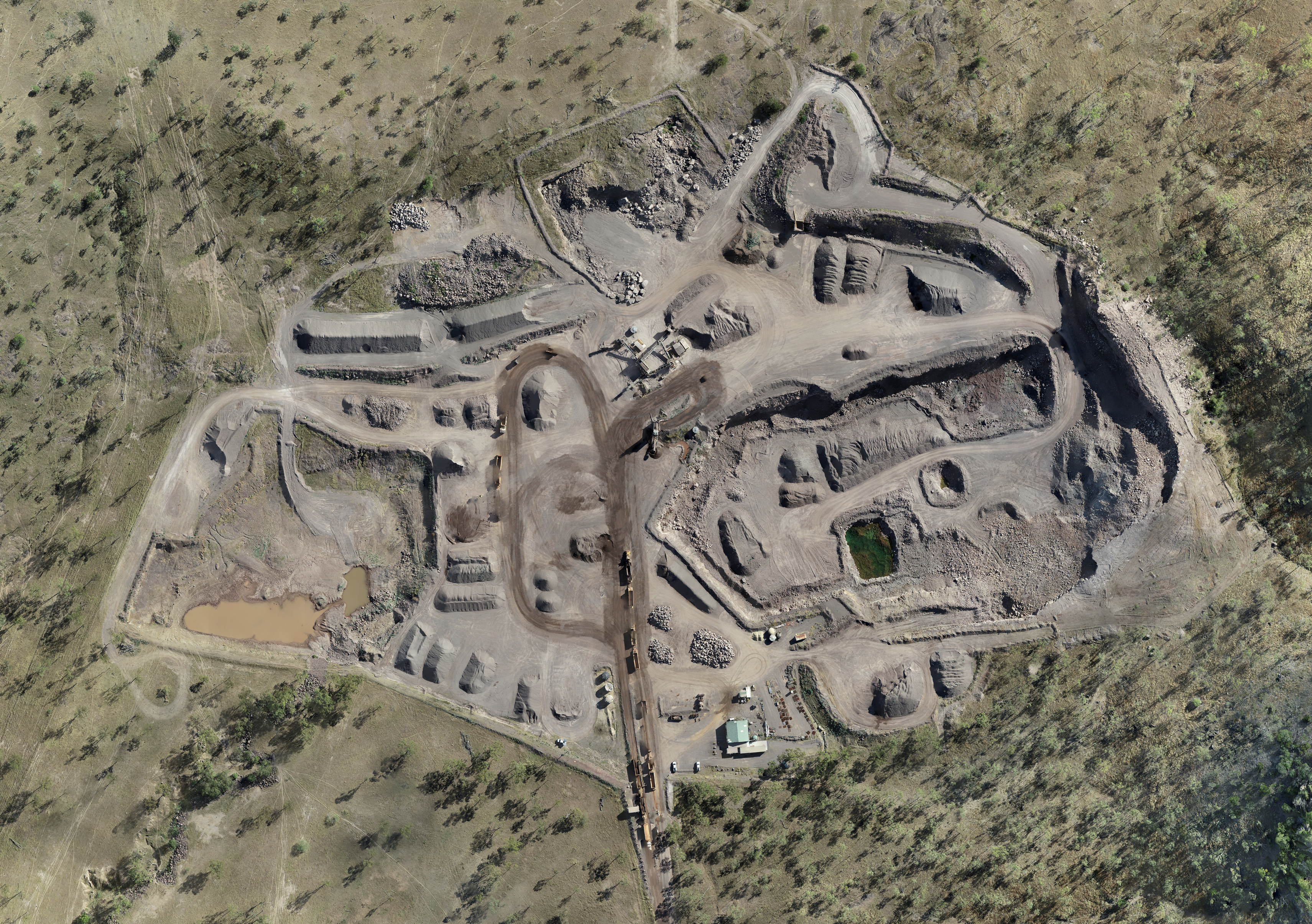
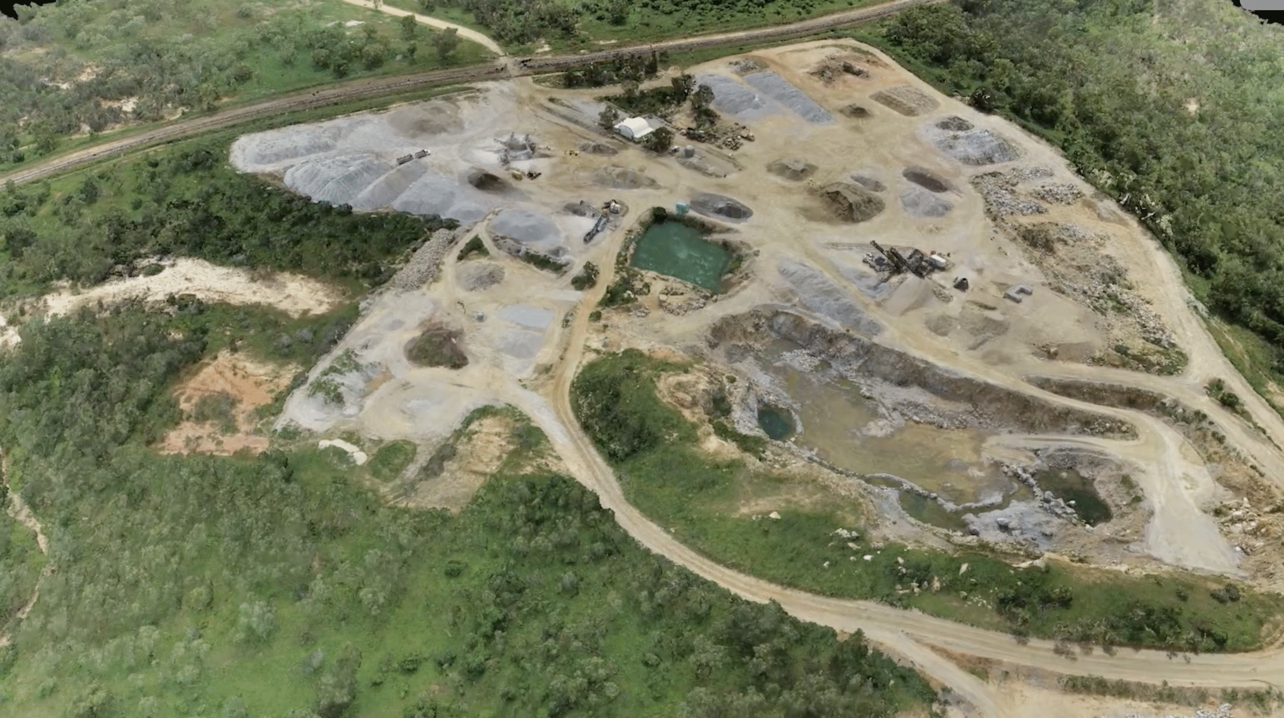
Mining & Quarries

Mine companies across the globe are integrating drone technology as a safer, faster, and more accurate alternative for stockpile management, monitoring and asset inspection.

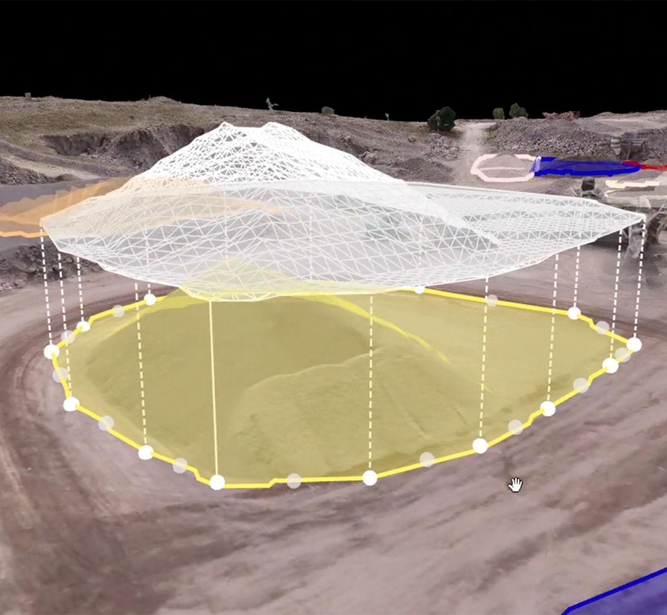
Mining drone pay loads are capable to capture data at a higher accuracy than other methods such as terrestrial, manned airplane and satellite surveys – and are less expensive. Combined with intelligent software, data outputs include contour maps, surface and elevation models and stockpile measurements. This highly accurate data is integral for auditing, reporting and planning. Furthermore, remote sensing prevents accidents and downtime –  keeping surveyors safe and the mine running incident-free.  

Spray and spreading drones are also becoming commonplace, providing vegetation control in challenging terrain such as waterways, dam walls, stockpiles, and rail corridors. 

Capabilities

Planning & Exploration

Aerial data collected by drones plays a crucial role in generating foundational geology maps used for the planning and excavation of assets.

Measure & Monitor

Clear and accurate contour maps, surface and elevation models for measuring and monitoring haul roads and water movement.

Hazard Identification

Addressing potentially hazardous site features and mitigating safety risks becomes more manageable with frequent and precise surveys of all active areas in your mine.

Stock Pile Management

Aerial cameras can gather data from hundreds of points, encompassing steep slopes and craters that may be imperceptible from ground level. Conducted aerially, operations are 100% safer than ascending stockpile slopes.

Revegetation & Environmental Management

Seed and spray challenging terrain, targeting specific areas where treatment is necessary, with a history of accurate data for reporting and auditing.

Shop Drones in Mining